THE 21ST century has seen the establishment of global and regional strategic milieu around the world. This strategic milieu persuades geo-economic and geo-political tactical partnership among regional countries. Regional connectivity is one of the most significant aspects of Pakistan’s foreign policy and Pakistan has been trying to develop good relations with its adjacent countries. Maintaining creditable and healthy relation with China has been an essential part of Pakistan’s foreign policy, as China is Pakistan’s strategic partner and helps Pakistan in maintaining balance of power in the region.
The history of Pak-China relations can be traced back since 1950 and both countries managed their connection in a very productive and articulated way. With the support of China, Pakistan has gained significant important not only in the region but the entire world. In recent years, both China and Pakistan developed a strong bond of trust and Chinese foreign policy gives a special focus to Pakistan in future endeavors of China. China-Pakistan Economic Corridor (CPEC) is one of the most prominent example of that. The CPEC is a megaproject that will connect Gwadar and Xinjiang via a network of highways, railways, and pipelines to transport goods, oil and gas. This economic corridor will run about 30,000 KM from Gwadar to Kashgar. The investment package is estimated at over $ 46 billion, comprising special economic zones, dry ports, energy projects, highways, railways, telecommunications, natural gas and oil pipelines connecting China to the Middle East and improving intelligence sharing between the two countries.
CPEC is an under-construction megaproject which will not only achieve the political and economic objectives through trade and development but also strengthen the economic and trade cooperation between the two countries. Pakistan’s leadership illustrates the CPEC as a game changer for Pakistan and the region. On the contrary, the dividends of this project will wholly turn up gradually over a period of 10 to 15 years thus requires an unremitting determination on the part of China and Pakistan to stay firm on the course. A strict scrutiny of the performance and quality of work on different projects is need of time. Similarly, safeguards are needed against corruption, pilferage of material and project payouts. Additionally, security concerns have been the most critical challenge to the CPEC and both Pakistan and China have been trying to meet these. Pakistan faces several challenges in the implementation of the project and these challenges include external and internal. Today’s biggest concern is the safety and security of engineers, technicians and labors working on the corridor project. Providing security to Chinese personnel is today’s major challenge for Pakistan.
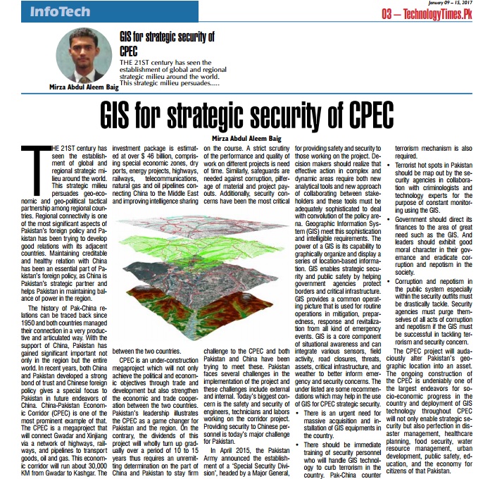
In April 2015, the Pakistan Army announced the establishment of a ‘Special Security Division’, headed by a Major General, for providing safety and security to those working on the project. Decision makers should realize that effective action in complex and dynamic areas require both new analytical tools and new approach of collaborating between stakeholders and these tools must be adequately sophisticated to deal with convolution of the policy arena. Geographic Information System (GIS) meet this sophistication and intelligible requirements. The power of a GIS is its capability to graphically organize and display a series of location-based information. GIS enables strategic security and public safety by helping government agencies protect borders and critical infrastructure. GIS provides a common operating picture that is used for routine operations in mitigation, preparedness, response and revitalization from all kind of emergency events. GIS is a core component of situational awareness and can integrate various sensors, field activity, road closures, threats, assets, critical infrastructure, and weather to better inform emergency and security concerns. The under listed are some recommendations which may help in the use of GIS for CPEC strategic security.
• There is an urgent need for massive acquisition and installation of GIS equipments in the country.
• There should be immediate training of security personnel who will handle GIS technology to curb terrorism in the country. Pak-China counter terrorism mechanism is also required.
• Terrorist hot spots in Pakistan should be map out by the security agencies in collaboration with criminologists and technology experts for the purpose of constant monitoring using the GIS.
• Government should direct its finances to the area of great need such as the GIS. And leaders should exhibit good moral character in their governance and eradicate corruption and nepotism in the society.
• Corruption and nepotism in the public system especially within the security outfits must be drastically tackle. Security agencies must purge themselves of all acts of corruption and nepotism if the GIS must be successful in tackling terrorism and security concern.
The CPEC project will audaciously alter Pakistan’s geographic location into an asset. The ongoing construction of the CPEC is undeniably one of the largest endeavors for socio-economic progress in the country and deployment of GIS technology throughout CPEC will not only enable strategic security but also perfection in disaster management, healthcare planning, food security, water resource management, urban development, public safety, education, and the economy for citizens of that Pakistan.


No comments:
Post a Comment